This was an extremely long day, 11 hrs full on hiking and driving, with a few rest stops and a very late dinner thrown in at the end. It all started at the Kilauea Visitor Centre and a video on how the volcanoes rose from deep within the sea to make the Hawaiian Islands as they are now. After collecting a few souvenirs it was off to a talk by the ranger on what to expect when you are in the park, what to do and more importantly what NOT to do in the park.
Our aim for the day was to travel the "Chain of Craters Road", a 62km round trip which descends 1128m to the coast and ends where lava has covered 10 miles of road since 1986. Along the way we did 5 hikes of varying lengths and in the end we worked it out to be about 1 months worth of hash walks in one day. The kids were troopers and loved every minute of it, even though as expected, they were too exhausted in the end to eat dinner at 9pm, they fell asleep while we waited for an hour for a table and then another hour for dinner. Everyone in the village was in the only restaurant waiting to be feed after a long days hiking. At least it was a fantastic Thai dinner and the margaritas we had while waiting made up for it.

Entry into the National Park.

Our very funny and informative park ranger, how is the spitting image of Steve Martin.

The history of the crater we were about to walk across.
Kilauea Iki Trail is a 122m descent through native rain forest into a crater of hardened lava lake which still has steaming vents from an eruption in 1959. The hike is a 6.4km round trip and a totally amazing feeling down on the crater floor.
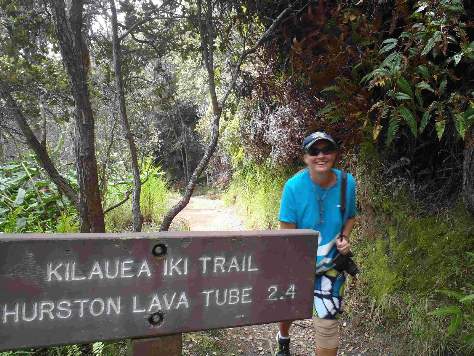
Heading down to the trail.

At the start of the walk down to the crater floor.

On the crater floor and getting ready to walk across.

Cracked up lava holes everywhere along the way.

It is hard to imagine the scale of it all and unfortunately the pictures do not do it justice.

Lyndon and Em leading the way across the crater floor, you had to be careful stepping around all the cracks. If you were to fall into one, you would be torn to shreds as the edges are extremely sharp.

Lyndon took this photo looking back across where we had started our walk from.

Some of the lava mounds were higher than Dylan.

The lava makes amazing shapes and patterns, this run off looked like a dried up creek bed.

Finally at the end of the trail, see this is where we walked, down into the crater, straight across, then all the way back up again. Wasn't so hard really!!!!
After this little stroll we headed into the Thurston Lava Tube. A 500 year old lava tube in the middle of a rain forest.
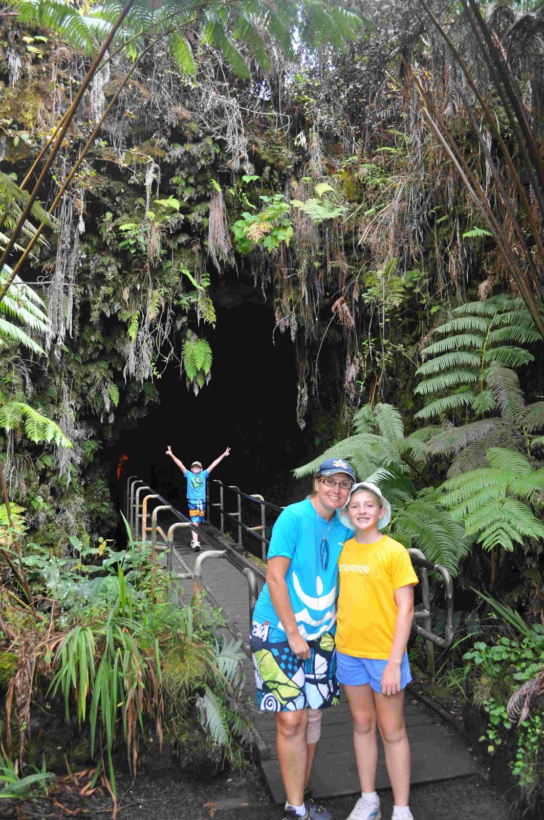
As usual, Dylan had to be the first into everything, and he never wanted to stick around for family photos.

Inside the lava tube.
Next adventure was the Pu'u Huluhulu Cinder Cone walk. We hiked over the 1973-1974 lava flows to a viewing area atop a 64m high cinder cone. This time it was more of a slog as we were getting tired and it was getting very hot. Many of the sights we saw along the way made up for it though. There was no dirt, just lava flows with trees and flowers sprouting out of the tiniest holes. We were amazed at how things can grow in such harsh conditions.

Hmmm.... should we really be doing this?? Of course - that is what everyone comes here for!!!

The kids pointed out this feature, which to them was a smaller version of the Ha'amonga Trilithon in Tonga.

Dylan took the leap of faith and jumped across this fault hole, the rest of us just walked down a little further and walked on the solid ground.

On of the many signs on the trail identifying where the January 1974 lava had flown and stopped.

Dylan standing on a petrified fallen tree.

Emily inside a burnt out tree stump, which she advised was not a very comfortable resting spot. It also looked like a huge elephant foot print.

The kids playing around a lava sheet. The whole place looked like a split up freeway, similar to scenes you see in a movie where the road is blown up.

Finally at the top of the cinder cone, unfortunately the clouds had come over and we could not see the smoking Pu'u O'o crater.
Back to the car for a snack and a rest, then it was off to the Pu'u Loa Petroglyphs. Here, a traditional Hawaiian trail leads to images artfully etched in stone. There is a boardwalk now around the etchings to protect them, and we all had guesses as to what they all meant back in the day. The information sign tells a little about their meanings and alot had to do with family and community.

Dylan's favourite - the stick man.

A selection of family etchings.

Nothing like a "selfie" in the middle of nowhere.
Back in the car again, this time off to the end of the road at the Holei Sea Arch. Along the way you could see steam clouds and smell the awful fumes VOG - volcanic gas (similar to dads butt, the kids kept saying). It was a beautiful drive down and amazing to see just how much work would have gone into cutting a road way through a lava flow so the tourists can travel through the park.

Nothing but lava on both sides for miles and miles and miles, all the way down to the sea edge.

Here we are at the end of the road, at the Holei Sea Arch. This arch is 18m tall and will eventually be carved away by the waves, until the side not attached to the land, falls into the sea. Notice how behind Lyndon, the lava flow comes all the way to the cliff.
After another little rest it was on to the last hike of the day. You could drive no further, so we had to walk to the end of "Chain of Craters Road" along some of the youngest land on earth where history was rewritten as new land was born. By the time we got to the end it was getting dark, so a snappy walk back was required. All up it was about a 1.5 hr hike across some rugged territory. With each new lava flow that travels further into the sea than the one before, new land is created. The Big Island of Hawaii is considerably bigger now than when it was first created.

Emily and her elephant poo patty.

Our version of the Beatles "Abbey Road" album cover. This road was taken out by a lava flow in 2003 so you can no longer drive around the entire island.

A little rest stop where the lava claimed the road.
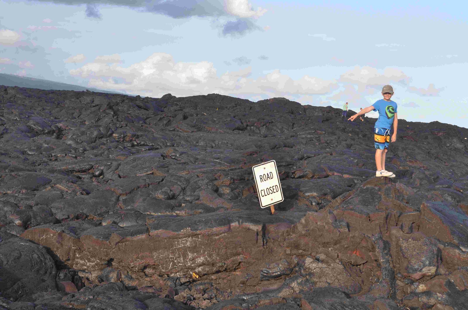
Dylan pointing out the obvious "Road Closed", we are quite high off the ground here.

Like a fire that saves one house and destroys the house next door, lava flow has no pattern. Some flows have huge volumes and consume absolutely everything while others, are a small trickle and do not travel far. Emily having a LLD on a section of road not covered by lava.

Family photo time.

Looking out to sea as the sun is starting to come down.

One last photo looking inland and time to head back to the car.
No comments:
Post a Comment